what days and when do you want to go?
Sunday, November 8, 2009
Piney Power!
Matt and I did a 9.5 mile through hike from Batsto to Atsion this morning. We met at Atsion at 8 this morning and it was cool to be traveling through farm country at dawn and seeing the fog lift slowly from the fields in the morning sun.The 9.5 miles from Batsto to Atsion was easy hiking but beautiful as always. The weather couldn't have been nicer. The old ankle started hurting about mile 7 and is a little sore now, but we got the whole thing done in about 4 hours with a quick lunch at Beaver Lake. Check out the pictures that Matt took.
Wednesday, October 28, 2009
Gemmer road to High Point
So, on Sunday, we actually did a different part of the AT instead of wind gap to kirkridge. We decided to go from Gemmer road to High Point State Park. The on-line companion states that this is a meager 5.5 mile trek. I think I must beg to differ on their opinion. The first half of the trek was in farmland and not too bad at all; it went smoothly. But then things took a turn for the worse, after rt 519, we headed into the woods and up to the rocky ridge. Maybe it was just that we're not used to the rocks, but that 5.5 miles took us 4 hours to do (we did stop for lunch). It was very fun though, but took a lot longer than expected and we ended up setting up camp in the dark. It got pretty dang cold that night and Amanda and Jill had a bit of trouble sleeping. I snored like a champ as usual. We then went to the high point monument the next morning and hacklebarney for hiking. After that apple cider donuts and hot apple cider at Alsteads to celebrate.
Friday, October 2, 2009
Water Gap to Kirkbridge Shelter
Shakedown #3: 10/24 & 10/25 - Water Gap to Kirkbridge Shelter and back....
http://bp2.trimbleoutdoors.com/viewTrip.aspx?tripId=368663. I can't find an exact map of the route, but it is included in the link (route from wind gap to water gap). We would basically start from the end of this route, hike 7 miles, stay overnight in the kirkbridge shelter or a meadow close by, and then return to water gap on sunday. who's in?!!
http://bp2.trimbleoutdoors.com/viewTrip.aspx?tripId=368663. I can't find an exact map of the route, but it is included in the link (route from wind gap to water gap). We would basically start from the end of this route, hike 7 miles, stay overnight in the kirkbridge shelter or a meadow close by, and then return to water gap on sunday. who's in?!!
Monday, September 28, 2009
Rocky Mountain National Park
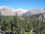
This weekend, Amanda and I went to Rocky Mountain National Park. The place was amazing. It was elk rutting season and we witnessed one buck chase another off of his potential mates. A nearly 800 pound animal charging at a group of people was something you don't see every day. But, the major event was that Amanda, Monique (lisa's friend who moved to Boulder), and I took around a 3 mile hike. We hiked from around 8800 feet (bierstadt trailhead) to an alpine lake at 9400 (bierstadt lake) where friendly ducks and chipmunks came right up to us to beg for food. We then hiked up to another lake (bear lake) at around 9500 feet. The whole trip was stunning and Amanda should be posting some pictures. It was cool to get back up into some real mountains, but I had forgotten how much the altitude makes you gasp for breath. Too much fun, I need to get back out there.
Wednesday, September 23, 2009
Upcoming 2nd Shakedown
On October 10th and 11th, we'll be doing our second shakedown for Dead Man's canyon. It will be an overnight at Round Valley Recreation Area http://www.state.nj.us/dep/parksandforests/parks/round.html. This will be a 3-6 mile hike in (depending on where our camp is; the campground is 3 miles long) and the same out. This will be a very moderate difficulty backpack; more difficult than Wharton. Bring your fishing poles and fishing licenses as it is at a reservoir. I think the cost will be about $25 for the campsite or about $6 each.
Subscribe to:
Posts (Atom)
